[ Crooked Brook starts here. ]

We left off last time at Jefferson Avenue, looking north at no brook. I will tell you the truth. It's hard to say exactly where the Crooked Brook runs for the next few blocks. This part took the most investigation. I'll try to explain my reasoning as we go.
Some property developer in this area we're going to look at, and maybe there was more than one, didn't want the Crooked Brook. It was put into a conduit and hidden. It wasn't a feature, it was a problem. A brook took up space that could be built on. But what a loss. I think people moving from the city to a fine suburban location would be charmed at seeing a little brook running near their property. They wouldn't think about heavy rains and flooding. They'd see the beauty of it.
Let's get exploring.
The storm drain you see at the curb up above has to be right over the Crooked Brook. We know that. Now there's an odd thing. The property of 73 Jefferson Avenue, the house on the left up there, does not extend to the corner. There's a narrow corner lot with no building on it.

Check the driveway. With a corner house, it's common around here that the driveway to the backyard garage would come off the side street, but this one can't do that. That space to the right of the driveway isn't part of the property. And that's not all. Although the driveway runs past the righthand side of the house, it curves to a garage awkwardly located in the back left corner (see it back there?). It's avoiding something.
Oddly enough there's a storm drain in the middle of the driveway, just past the house, which you can almost see in the photo above. Even stranger, there's a second drain in the lawn to the right of the driveway near the garage.
So, I think the property line separating this house and the corner lot is more or less the Crooked Brook. I think the brook runs just to the right of the driveway, curving to the left so that it can run behind the houses on Kendal Avenue (like the yellow one back there). That's my guess, because I think the builders wouldn't put a house right over the brook. But maybe they did.
Helen and I wandered around the next few blocks looking for any storm drains or grates where we could hear the brook. I'd better give you a map, and then I'll explain it.

Near the bottom, there's 73 Jefferson Avenue, with the garage in its back left corner. Notice the empty corner lot at 65-67. The blue spots are the grates I just mentioned. Move up block by block.
The low point in the grade of Garthwaite Terrace is between the house and garage of 75 Kendal. There are storm drains at that point on both sides, but we could not actually hear the brook, so I have not put blue spots there. I did put a blue spot showing a storm drain at the similar low point on Hoffman Street, between 65 Kendal and 30 Hoffman, where we heard running water. I'm pretty sure the brook runs behind the houses from 77 to 65 Kendal.
The next one is interesting. We heard water at a drain in Headley Place near the back of 25 Hoffman, and then at a corner drain near the side of 12 Arcularius Terrace. Both are marked with blue spots. It's as if the brook ran across the street diagonally. The photo below shows the two storm drains.

The grey line I drew on the map corresponds to something in the Sanborn atlas of 1912. This is really cool because I think it confirms that the brook really does cross Headley Place at that angle. Here's an image tiled together from two Sanborn atlas plates.

Look at Headley Place! You can't build a street with that wedge in it. Here's what must have been happening. The land was just being subdivided for building in 1912, and not all of the proposed Headley Place had yet been dedicated as a public street. The farm on the northwest side was still one large property. (By the way the two houses of this farm, circa 1800, still stand, with alterations, at 452 and 455 Ridgewood Road.)
That old property line is what I drew in grey on the first map. It just happens to be at the same place where we thought the line of the Crooked Brook slants across Headley Place. I believe this line is a remnant of the colonial property line along the Crooked Brook that is mentioned at the top of Crooked Brook I.
I don't know whether the brook still follows the old line. In the block from Arcularius Terrace (a name you do not find in every town) to De Hart Road, it runs either under or behind the houses along Headley Place.
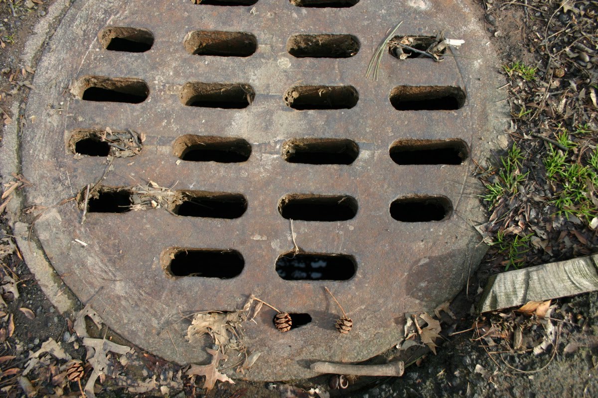
The next place we could find running water was a round grate in the street in front of 14 De Hart Road. This doesn't help establish how the brook gets here from the previous location.

Coming up is Orchard Park. I knew the Crooked Brook must run under the park, because we will finally see it again at the Timothy Ball House, and the park is on the way there.
We found another round grate in the park, next to the paved walk just beyond the back of 19 De Hart Road. We could not only hear running water, we could see the Crooked Brook. I even got it into photograph.

Orchard Park exists because of an old flower business. The remnant of it is Gefken Florists, at 432 Ridgewood Road. It's a commercial property in a residential area, not conforming to zoning, but it is allowed because it was already there when the zoning laws were adopted, sometime early in the twentieth century. The business had greenhouses and planted fields behind it.
Part of Orchard Park is a wetlands. It's been like this for centuries. The Crooked Brook overflows here. Below, a photo taken not right after a rainstorm, in the part of the park shown by the big open circle up there in the first map.

I bet kids love stomping around in that muck. Parents were keeping their little critters shepherded onto the other side of the walk when we were there, but you know how they break free sometimes.
The house at 426 Ridgewood Road, across the road from the Timothy Ball House, was already there in 1912. I know this because it's shown on the Sanborn map, and by its style it looks to me like it's from the 1870-1900 period, older than most houses in the neighborhood. That would put its construction before the date the Crooked Brook was placed underground here. My guess is that the brook ran along the north side of the house.
Below, the light blue line shows a very speculative path for the Crooked Brook under ground, summarizing what I've been saying so far. It's based on the concept of the brook running around, not under, buildings. It's probably not quite correct.

Below, a view from looking across from 426 Ridgewood Road, showing the Timothy Ball House on the left. That little iron fence at right center protects passersby from stumbling into the Crooked Brook as it enters the conduit that will carry it downstream by hidden ways.

More pictures of the house are at Stone House III.
And here we pause.
We're almost done. Next time, we will follow the brook all the way to its source. It might not be Lake Victoria, but it's still going to be pretty good.
When I started this, I didn't know whether I would be able to tell you definitively where the Crooked Brook starts. I imagined myself wandering in the woods up on the mountain trying to guess which stream bed might be the one. But it turns out that I can tell you exactly where our brook originates. I have been there. I admit I wasn't the first White Man to see it. But still, next time, the Big Finish.
My photographs were taken on March 27 and April 4, 2010. The present-day property maps are from the Township of Maplewood.
Next time: Crooked Brook IV.
There is a circular drain in the middle of Kendall where Hoffman intersects with Kendall. There was water running through it. I wonder if this is also part of the Crooked Brook?
ReplyDelete